
A TROPICAL STORM WATCH IS IN EFFECT FOR BARBADOS
A tropical-storm watch is issued when sustained winds of 34 to 63 knots (39 – 73 mph; 63 – 118kmh) associated with a tropical storm or hurricane is possible to affect Barbados within 48 hours.
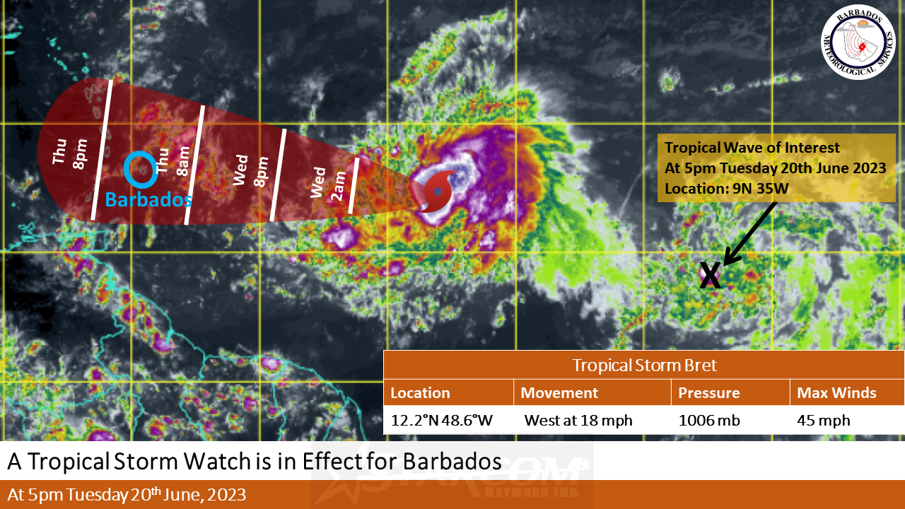
**** Hazard Info ****
At 5:00 PM, the center of Tropical Storm Bret was located near latitude 12.2N 48.6W or approximately 740MI (1190KM) east of Barbados.
The center of Bret and its strongest winds are expected to pass approximately 62MI (100KM) to the north of Barbados, therefore given the close proximity to the north of the island, a tropical storm watch is in effect.
Maximum sustained winds have increased to near …45 MPH…75KMH Current movement…West (280) AT 18MPH…30KMH…Minimum central pressure… 1006MB
Expected Impacts:
Marine conditions are forecast to deteriorate from Wednesday night 21st June 2023 into early Friday morning. Moderate to rough swells of 2.5m to 3.5m (8 ft to 11ft) in open water around Barbados is expected to generate choppy conditions which will particularly affect the islands’ eastern and northern coastlines. As a result, a small craft and high surf advisory are in effect. Mariners are advised not to venture too far from port and secure their vessels leading up to Wednesday night.
Outer bands of Tropical Storm Bret will begin to affect the island from early Thursday morning with showers and gusty winds. Rainfall accumulations of 1 to 3 inches (25 to 75mm) is likely across the island. This may result in flash flooding in low-lying districts. Persons in these areas should begin to make the relevant preparations to protect property and life.
The next Advisory will be issued at 8:00 PM Tuesday, 20th June 2023.
-The Barbados Meteorological Services