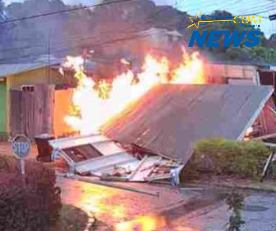
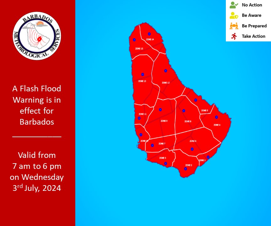
Excessive rainfall today Wednesday 3rd July 2024 could generate flooding across low-lying areas in Barbados and the surrounding areas. Therefore, the Barbados Meteorological Services has issued a Flash-Flood Warning for Barbados.
These conditions are predicted to peak this morning into the afternoon with some improvement during the course of this afternoon.
**** Hazard Info ****
Possible Impacts
- Runoff from higher elevations. Soil erosion on exposed or scarred land surfaces.
- Water settlements on roads and fields at the foot of hills and coastal roads.
- Debris from higher elevations becoming embedded within fast-moving water flows.
- Delays on traffic routes with some roads becoming impassable.
What you should do
-The public should follow recommendations from the Department of Emergency Management. The public is encouraged to monitor the BMS, DEM, and GIS websites and their respective social media pages along with the local media networks for further updates.
Discussion
A tropical wave has already begun to affect Barbados this morning, Wednesday 3rd July 2024. Mostly cloudy skies with periods of heavy to intense showers, accompanied by gusty winds, and possible isolated thunderstorms are forecast. Rainfall Accumulations of 32mm ( over 1 inch) have already occurred across some sections of the island and another 25mm to 75mm (1 to 3 inches) are possible.
General Information
A flash-flood warning is issued when rapid flooding due to heavy or excessive rainfall in a short period of time (generally less than 6 hours) is occurring or is imminent in the warning area.
This Flash-Flood Warning was issued at 7am, 3rd July 2024, and will be terminated at 6pm or sooner if conditions warrant.