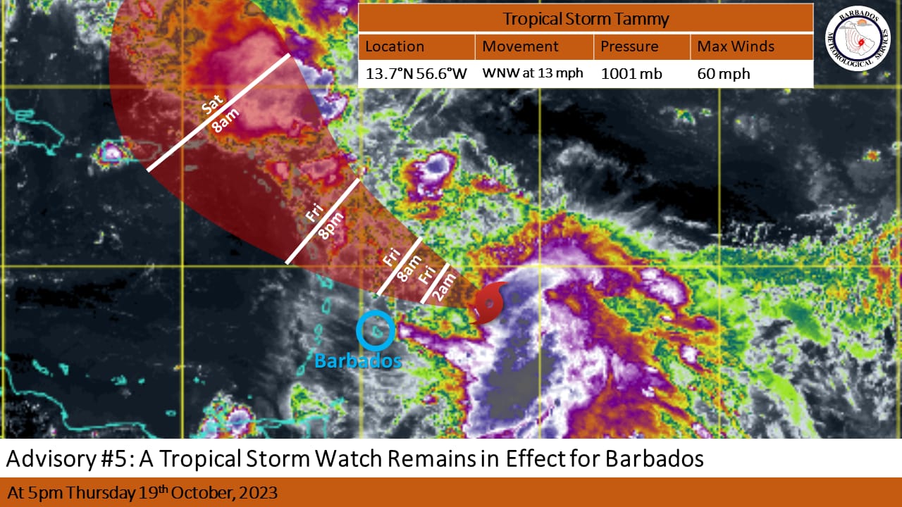
A TROPICAL STORM WATCH REMAINS IN EFFECT FOR BARBADOS**
A tropical storm watch is issued when sustained winds of 34 to 63 knots (39 – 73 mph; 63 – 118kmh) associated with a tropical storm are possible in the warning area within the next 48 hours.
**** Hazard Info ****
There are no significant changes to the track of Tammy and the potential impacts expected for Barbados from Tropical Storm Tammy since the previous update at 2:00pm.
At 5:00 pm, the center of Tropical Storm Tammy was located near 13.7N 56.6W, or approximately 200 miles ( 320KM) east of Barbados. Maximum sustained winds remain near 60 MPH ( 95KM/H). Tammy continues to gradually slow down and is currently moving west northwestward at 13MPH (20KMH) with a minimum central pressure of 1001 MB.
Expected Impacts: –
Marine conditions are forecast to deteriorate from tonight Thursday 19th October 2023 with moderate to rough swells of 2.5 m to 3.5 m (8ft to 11ft) in open water. As a result, a small craft warning and high surf advisory is in effect for Barbados.
Possible Impacts: –
On its current track the system is projected to pass approximately 110 miles north of the island on Friday afternoon. Any southward deviation to the projected track can result in the watch being upgraded to a warning at short notice.
Some showers are expected to occur tonight into tomorrow morning, however, shower activity is likely to increase Friday afternoon into Saturday morning. Occasional winds gusting to storm force in moderate to heavy showers associated with feeder bands are possible during that time. The BMS is forecasting slightly lower rainfall accumulations of around 1 to 3 inches with isolated higher amounts.
(Source: Barbados Meteorological Services)