
The Barbados Meteorological Service has said that the tropical wave to the east of Barbados could produce 2 to 3 inches of rainfall with isolated higher amounts of 4 inches in moderate to heavy showers. Winds are currently predicted to range between 25 to 35 mph with higher gusts of 45 to 55 mph.
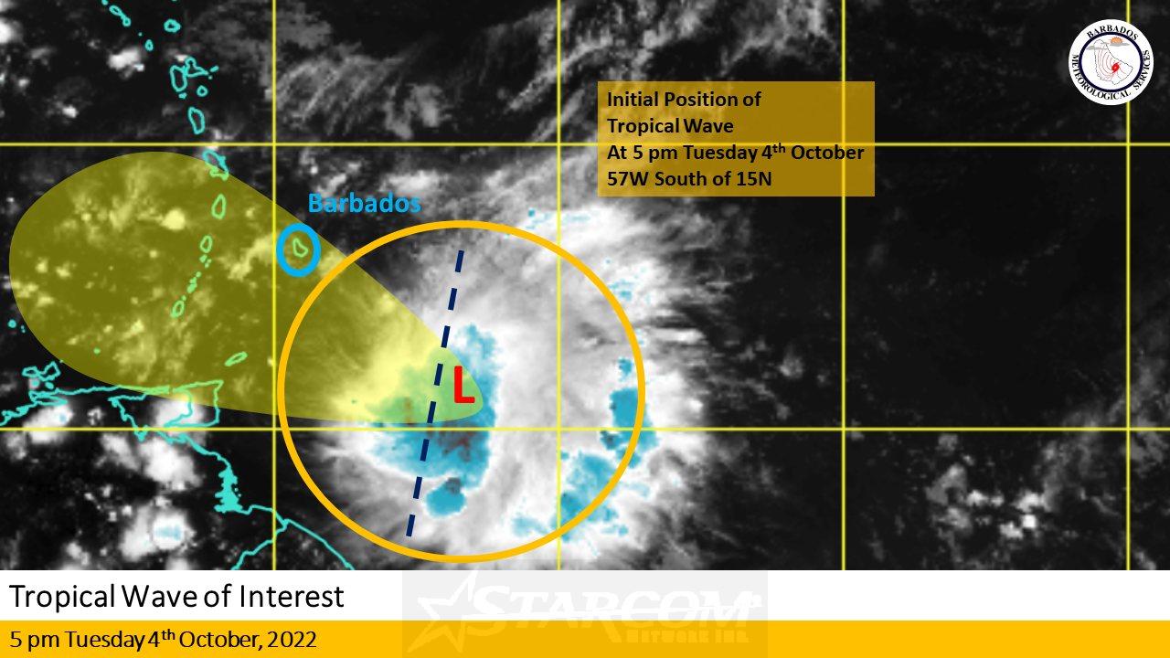
The Barbados Meteorological Services has stated they continue to closely monitor the progress of a tropical wave located near 57W south of 15N at 5 pm this evening, Tuesday 4th October 2022.
The system is expected to track west to west-northwestward at 15 to 20 mph over the next 12 to 24 hours. This should bring the system into our area in the early hours of tomorrow, Wednesday, 5th October 2022.
Regardless of development, this wave could produce 2 to 3 inches of rainfall with isolated higher amounts of 4 inches in moderate to heavy showers. Winds are currently predicted to range between 25 to 35 mph with higher gusts of 45 to 55 mph.
The public is advised to stay alert for updates from the BMS on this system over the next 6 to 18 hours. The next update will be at 11 pm tonight Tuesday 4th October 2022 or sooner if conditions warrant. For more information please visit www.barbadosweather.org


2 Responses
4.5
4