
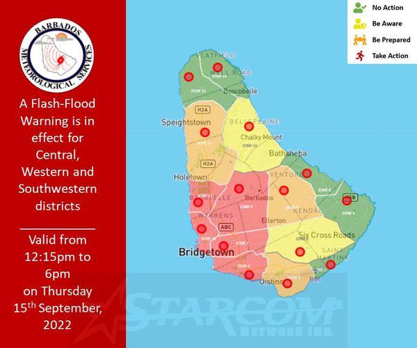
This alert message is valid from 12:15 pm Thursday 15th September 2022 and will be terminated at 6:00 pm Thursday 15th September 2022 or sooner if conditions warrant.
A flash-flood warning is issued when rapid flooding due to heavy or excessive rainfall in a short period of time (generally less than 6 hours) is occurring or is imminent in the warning area.
Maximum rainfall accumulations of 25.0 mm to 75.0 mm in heavy to violent showers are anticipated across the central, western, and southwestern districts of Barbados today as instability associated with Tropical Storm Fiona affects the island throughout the afternoon.
Key Message: Residents and visitors should note that the following impacts are imminent during this forecast period :-.
-Strong runoff from higher elevations.
-Some soil erosion on bared or scarred land surfaces.
-Debris such as small rocks, mud, and tree foliage could end up on roads and property.
-Flooding at the foot of hillsides and coastal roads.
-Water settlements on roads and fields.
-Increased levels of existing water bodies (e.g ponds etc.).
-Some delays on traffic routes in the area.
For more information specific to your area, please visit: https://www.barbadosweather.org/weatherBarResp.php